Geoscience

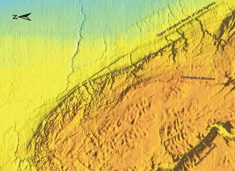
Darlingford Moraine Area Image #4
The Darlingford moraine represents the western limit of the Red River glacial ice lobe, which at it's maximum, covered an area from the Manitoba escarpment to the Canadian shield and into United States. One of the last ice lobes to leave southern Manitoba, the Red River lobe was very thin and was readily confined by any high area such as the Manitoba escarpment, but easy expanded into the gaps in the eascarpment, such as near Brandon and Dauphin.
- Darlingford Moraine Introduction and Image #1
- Darlingford Moraine Image #2
- Darlingford Moraine Image #3
Undraped DEM, 1.5x VE, Orthogonal View
A larger DM Image #4