Geoscience

Sandilands Moraine
Introduction:
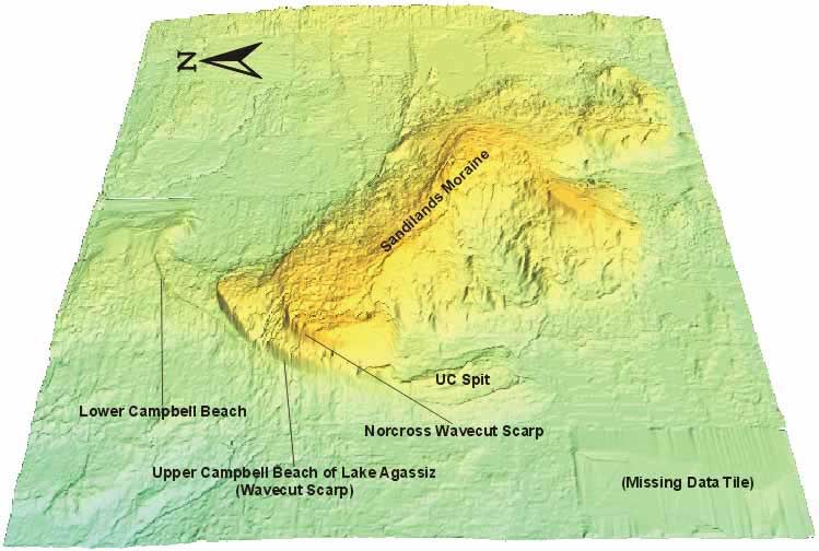
 The Sandilands interlobate moraine stands about 80 metres above the surrounding plain and is predominantly composed of sand. This area was an island throughout much of the history of glacial Lake Agassiz, as is evident from the numerous beaches (for example the upper and lower Campbell beaches) encircling the feature.
Sandilands Image #1
Undraped DEM, 1.5x VE, Oblique View
For a large view of this image