
Suitability of Land for Irrigated Potato Production
The suitability of soil conditions and landscape features for irrigated potato production is based on soil resource information from detailed soil maps (1:20000 to 1:50000 scale) and soil databases.
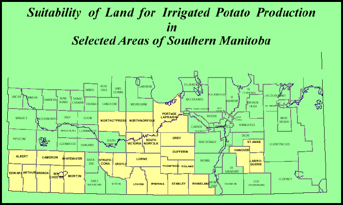
Each map (from RM's in yellow on the map above) is downloadable as a PDF file in the table below.
Maps for Suitability for Irrigated Potato Production for Rural Municipalities of Manitoba | |||||||
| RM | PDF file size | RM |
PDF file size | RM | PDF file size | RM | PDF file size |
| Albert | 299KB | Argyle | 141KB | Arthur | 483KB | Brenda | 356KB |
| Cameron | 463KB | Dufferin | 417KB | Edward | 454KB | Grey | 414KB |
| Hanover | 244KB | La Broquerie | 194KB | Lorne | 313KB | Louise | 388KB |
| Morton | 398KB | North Cypress | 599KB | North Norfolk | 657KB | Pembina | 306KB |
| Portage | 869KB | Rhineland | 454KB | Roland | 256KB | South Norfolk | 378KB |
| Springfield | 607KB | Stanley | 342KB | Ste. Anne | 218KB | Strathcona | 309KB |
| Thompson | 282KB | Victoria | 490KB | Whitewater | 255KB | Winchester | 342KB |
Information considered in evaluating soil characteristics and landscape features are:
- Soil texture and thickness and uniformity of deposits
- Topography
- Stoniness
- Salinity
- Soil drainage
- Soil Order and Subgroup
Only the dominant soil series and landscape features for each polygon are used in the evaluation and in map production. Subdominant soil conditions and landscape features should also be considered when assessing a given land area for irrigated potato production.
The rating of soil and landscape characteristics for a given land area will assist in making an initial assessment of land suitability for irrigated potato production. The next step should involve an on-site investigation. Factors such as water supply, climate, agronomic practices, or economics that influence the decisions of whether land should or should not be used for irrigated potato production are not considered in this assessment.
Description of Suitability Classes
Class 1 - Lands in this group generally have the following characteristics
- Soils are well to rapidly drained soil textures usually range from loamy very fine sand, sandy loam to loam
- Soils are nonstony and have level to very gently sloping (0 to 5 %) topography salinity levels in the soil profile (0~60 cm) are very low
Class 2 - Lands in this group generally have the following characteristics
- Soils are well to rapidly drained
- Soil materials usually include sandy (coarse) textures such medium and fine sand, loamy sand; and finer textures such as clay loam and silty clay loam
- Soils are nonstony and have level to very gently sloping (0 to 5 %) topography
- Salinity levels in the soil profile (0~60 cm) are very low
Class 3 - Lands in this group generally have the following characteristics
- Soils are well to rapidly drained
- Salinity levels in the soil profile (0~60 cm) range from 0 to 4 mS/cm (nonsaline)
- Soil materials usually include sandy (coarse) textures such medium and fine sand, and loamy sand underlain by silty clay and clay materials; and finer textures such as loam, clay loam and silty clay loam underlain by coarse sand and gravel
- Soils are nonstony and have level to very gently sloping (0 to 5%) topography
- Soils are imperfectly drained
- Textures are similar to soils in class 1 and 2
- Salinity levels in the soil profile (0~60 cm) range from 0 to 4 mS/cm (nonsaline)
- Soils are nonstony and have level to very gently sloping (0 to 5%) topography
Class 4 - Lands in this group generally have the following characteristics
- Soils are well to imperfectly drained
- Salinity levels in the soil profile (0~60 cm) range from 4 to 8 mS/cm (weakly saline)
- Soils are slightly stony and have gently sloping topography (5 to 9 %)
- Soil materials usually include a range of textures underlain by clay textured materials
Class 5 - Lands in this group generally may have one or more of the following characteristics
- Salinity levels in the soil profile (0~60 cm) are greater than 8 mS/cm (moderately to strongly saline)
- Soils are moderately to excessively stony (st. 2,3,4,5) and have moderate to very steep slopes (greater than 9 %)
- Soil textures are usually gravels, and/or clay; soils underlain by bedrock within 120 cm and soils with textural complexes, undifferentiated and fragmental materials
- Organic, gleysolic and solonetzic soils