
Geoscience

Red River Valley
Introduction:
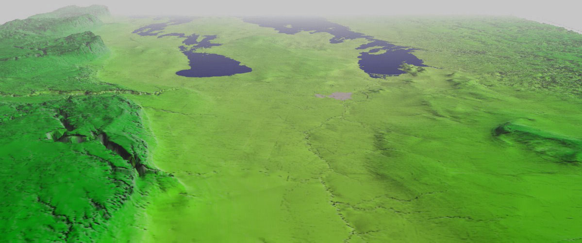
 A three-dimensional perspective of the Red River valley in southern Manitoba derived from the MGS Digital Elevational Model. The provincial capital, Winnipeg, appears as the gray region directly south of Lake Winnipeg. The dramatic rise in elevation to the west reflects the beginning of the Manitoba escarpment, where Cretaceous shales mark the division between the first and second levels in the Canadian prairies. The rugged Canadian Shield occupies the northeastern portion of the image.
The wide valley flanking the Red River was formed as a major depositional basin of glacial Lake Agassiz, and, as a result, is covered by tens of metres of clay. The Pembina and Assiniboine channels are deeply incised into the Cretaceous shale above the escarpment and have deposited large sand and gravel fans at the base of the escarpment where they entered Lake Agassiz. Because these proglacial channels (called ‘spillways’) have eroded into shale, they are the primary source of the clay deposited in the Winnipeg area.
The modern Red River flows northward across this extraordinarily flat relict lake bottom and, as a consequence, southern Manitoba has often been affected by extreme spring floods spilling across the entire valley. The second image shows the extent of the 1997 flood within the Canadian portion of the Red River valley. The 1997 flood is the second largest flood in the Winnipeg-region in at least 350 years, exceeded only by the record Red River flood of 1826.
Red River Valley image #1
Undraped DEM, 30x VE, Oblique View
For a large view of this image
Manitoba Geological Survey 2002, image created using Virtual Frontier for MapInfo using SRTM 90 metre data (Image by Greg Keller).