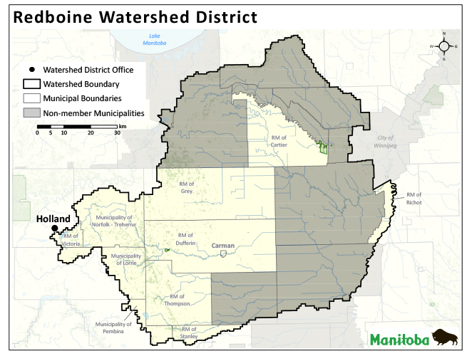
Redboine Watershed District |
Redboine Watershed District is located in southern Manitoba and includes all or parts of the participating municipalities of Victoria, Norfolk Treherne, Dufferin, Grey, Cartier, Ritchot, Stanley, Thompson, Lorne and Pembina; and the Town of Carman. The district encompasses an area of approximately 5,200km² and was formed in 2002 as the LaSalle Redboine Conservation District. On January 1, 2020, through proclamation of the Watershed Districts Act, all of Manitoba’s 18 conservation districts transitioned to 14 new watershed districts, with boundaries based on watersheds.
The La Salle River Integrated Watershed Management Plan was completed in 2010, and is now in the implementation phase. The plan is a guide for local watershed programming, with identified actions and goals for the conservation district and stakeholders to implement. Surface water management, groundwater protection, riparian area health, water quality improvement and public education are the focus of the district’s programs. The Boyne-Morris Integrated Watershed Management Plan is currently under development.
Box 220, 109 Broadway Street
Holland, Manitoba, R0G 0X0
204.526.2578 (P)
204.526.2298 (F)
www.redboine.com
redboinewd@gmail.com


