Geoscience

Geological Survey Activity Tracker

Manitoba Geological Survey logo

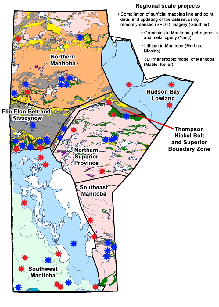
The Manitoba Geological Survey (MGS) Activity Tracker provides quick and easy access to information on Manitoba Geological Survey projects conducted throughout the province. Use the interactive map to find and select project details and outcomes. To use the map:

  • Click on a red star on the provincial map to access project summaries which include a brief description, plans for the upcoming year and all completed outputs with links to digital products available for free download.
  • Blue stars represent recently completed projects by the MGS.
  • To find more completed projects in your area of interest, please visit the Bibliography of Manitoba Geology.
  • Having trouble viewing the map? Visit our Projects page to find an itemized list of MGS activity in each area.
  • The Manitoba Geological Survey welcomes your comments and questions regarding the Geological Survey Activity Tracker. Please visit our MGS Staff Directory page for more information.

Map of Manitoba Property
Northern Manitoba

Geological mapping and compilation at
Southern Indian Lake
(Martins)

PROJECT STATUS: COMPLETED (2019)
Property
Northern Manitoba

Far North geomapping initiative: northwest Manitoba
(Böhm, Gauthier, Couëslan)
Property
Northern Manitoba

Rare metals and REE
(Brezden Lake)
(Martins, Couëslan, Böhm)

PROJECT STATUS: COMPLETED (2016)
Property
Hudson Bay Lowland

GEM energy: Hudson Bay
and Foxe Basins project
(2008-2013)
GEM 2: Hudson–Ungava
Project (2013-2020)
(Nicolas)
Property
Flin Flon Belt and Kisseynew

Rare metals and REE (Burntwood syenite)
(Martins, Couëslan, Böhm)

PROJECT STATUS: COMPLETED (2016)
Property
Flin Flon Belt and Kisseynew

Geology and geochemistry of arc and ocean-floor volcanic rocks in the northern Flin Flon Belt, Embury-Wabishkok-Naosap lakes area, Manitoba
(Gilbert)

PROJECT STATUS: COMPLETED (2015)
Property
Flin Flon Belt and Kisseynew

Geology and mineral potential of the Brunne Lake area
(Gagné)

PROJECT STATUS: COMPLETED (2019)
Property
Flin Flon Belt and Kisseynew

Reed Lake compilation and geological mapping
(Gagné)

PROJECT STATUS: COMPLETED (2019)
Property
Thompson Nickel Belt and Superior Boundary Zone

Surficial geology, till composition and ice-flow history in the Gillam area
(Gauthier)
Property
Flin Flon Belt and Kisseynew

Snow Lake VMS: an investigation of the precious metal occurrences, metamorphism and alteration of selected VMS deposits from the Snow Lake area
(Gagné)

PROJECT STATUS: COMPLETED (2019)
Property
Flin Flon Belt and Kisseynew

Snow Lake - Squall Lake - Herblet Lake: compilation and geological mapping
(Gagné, Beaumont-Smith)

PROJECT STATUS: COMPLETED (2019)
Property
Flin Flon Belt and Kisseynew

Structural and stratigraphic controls on gold mineralization in the New Britannia mining district
(Rubingh, Gagné)

PROJECT STATUS: COMPLETED (2019)
Property
Thompson Nickel Belt and Superior Boundary Zone

Geology of Paint Lake
(Couëslan)

PROJECT STATUS: COMPLETED (2016)
Property
Thompson Nickel Belt and Superior Boundary Zone

The Grass River project
(Couëslan)

PROJECT STATUS: COMPLETED (2016)
Property
Northern Superior Province

Pikwitonei Granulite Domain mapping program
(Couëslan, Böhm)
Property
Northern Superior Province

Rare metals and REE
(Cinder Lake)
(Martins, Böhm)

PROJECT STATUS: COMPLETED (2016)
Property
Northern Superior Province

Surficial geology mapping in the Knee Lake area, in support of Operation Superior (1996-2001) exploration
(Gauthier)

PROJECT STATUS: COMPLETED (2015)
Property
Southwest Manitoba

TGI 2: Williston Basin architecture and hydrocarbon potential in eastern Saskatchewan and western Manitoba
(Nicolas, Keller, Matile, Chackowsky, Lenton, Conley)

PROJECT STATUS: COMPLETED (2018)
Property
Southwest Manitoba

Petroleum geology and stratigraphy of the Late Devonian-Early Mississippian Three Forks and Bakken formations, southwest Manitoba
(Nicolas)

PROJECT STATUS: COMPLETED (2012)
Property
Southwest Manitoba

Shallow unconventional shale gas project
(Nicolas, Bamburak)
Property
Southwest Manitoba

Industrial/specialty minerals investigations
(Bamburak, Lapenskie, Nicolas)

PROJECT STATUS: COMPLETED (2016)
Property
Southwest Manitoba

Stratigraphy, sedimentology and petroleum geology of the Devonian Duperow Formation, southwestern Manitoba
(Nicolas)
Property
Southeast Manitoba

Geology of the Bird River Belt
(Zhou, Lin, Anderson)

PROJECT STATUS: COMPLETED (2019)
Property
Southeast Manitoba

Geological mapping of the Mayville and Euclid Lake area, Manitoba
(Yang)

PROJECT STATUS: COMPLETED (2020)
Property
Southeast Manitoba

Detailed structural mapping and analysis of shear zones and auriferous vein systems in the Rice Lake mine trend
(Anderson)

PROJECT STATUS: COMPLETED (2019)
Property
Southwest Manitoba

Geolocalities/roadside geology of Manitoba
(Bamburak, Pacey)
Property
Northern Manitoba

Rare metals and REE
(Southern Indian Lake)
(Martins)

PROJECT STATUS: COMPLETED (2016)
Property
Northern Manitoba

Surficial Geology mapping east of Southern Indian Lake
(Gauthier)

PROJECT STATUS: COMPLETED (2015)
Property
Northern Manitoba

Far North geomapping initiative: quaternary
(Gauthier)

PROJECT STATUS: COMPLETED (2022)
Property
Southeast Manitoba

Long Lake gold metallogeny (CRD)
(Zhou, Lin, Anderson)

PROJECT STATUS: COMPLETED (2019)
Property
Northern Manitoba

Geology, lithogeochemistry and metallogeny of the Lynn Lake greenstone belt, northwestern Manitoba
(Yang, Beaumont-Smith)
Property
Northern Superior Province

Geological compilation of the Oxford Lake–Knee Lake greenstone belt
(Anderson)

PROJECT STATUS: COMPLETED (2019)
Property
Southwest Manitoba

Surficial geology mapping of the Arden area
(Hodder, Gauthier)

PROJECT STATUS: COMPLETED (2020)
Property
Southwest Manitoba

Investigation of gypsum and anhydrite in Manitoba
(Lapenskie, Bamburak, Nicolas)
Property
Flin Flon Belt and Kisseynew

Metamorphism in the
Flin Flon Belt
(Lazzarotto, Pattison,
Gagné, Couëslan)
Property
Northern Superior Province

Geology and mineral potential
of the Bigstone Lake greenstone belt
(Rinne)
Property
Northern Superior Province

Geological compilation
of the Fox River belt
(Rinne)

PROJECT STATUS: COMPLETED (2020)
Property
Hudson Bay Lowland

Till sampling and
stratigraphy of the
Kaskattama highland region
(Hodder, Gauthier)
Property
Northern Manitoba

Ice-flow indicator
mapping and till sampling
of the Southern Indian Lake area
(Hodder, Gauthier)

PROJECT STATUS: COMPLETED (2018)
Property
Southwest Manitoba

Surficial geology
mapping in the
Pilot Mound-Morden area
(Hodder, Gauthier)
Property
Southwest Manitoba

Silica sands of
the Winnipeg Formation
(Lapenskie, Bamburak, Nicolas)
Property
Southwest Manitoba

Evaluation of drill core
from the Tower property,
Grand Rapids
(Couëslan)
Property
Northern Manitoba

Till sampling and ice-flow
mapping between Leaf Rapids,
Lynn Lake and Kinoosao,
northwest Manitoba
(Gauthier, Hodder)

PROJECT STATUS: COMPLETED (2019)
Property
Flin Flon Belt and Kisseynew

Investigation of "kimberlite-
like" rocks from the south
Wekusko Lake area,
north-central Manitoba
(Reid)
Property
Southwest Manitoba

Geology of the eastern
sub-Phanerozoic Flin Flon belt
(Reid)
Property
Hudson Bay Lowland

Till sampling and Quaternary
stratigraphy of the
Machichi–Kettle rivers area
(Hodder, Gauthier)
Property
Southeast Manitoba

East Side Road reconnaissance
mapping project
(Rinne, Gauthier)
Property
Southwest Manitoba

Mississippi Valley-type (MVT) Zn-Pb
deposit potential in Manitoba
(Lapenskie, Reid, Rinne)
Property
Northern Superior Province

Surficial geology mapping and till composition of the western Fox River belt
(Gauthier)
Property
Southwest Manitoba

Quaternary history
of the
Roseau River area
(Gauthier, Hodder)
Compilation of surficial mapping line and point data, and updating of the dataset using remotely-sensed (SPOT) imagery (Gauthier) 3D Phanerozoic model of Manitoba (Matile, Keller) Lithium in Manitoba (Martins, Nicolas) Granitoids in Manitoba: petrogenesis and metallogeny (Yang)

back to top