2014 Flood
Manitoba experienced one of the coldest and longest winters on record in 2013/2014, resulting in thicker than usual ice along many rivers and lakes. Spring runoff in 2014 was generally slow to respond and produced moderate to high volumes of flow. The longer period of runoff resulted in above average spring peaks and; therefore, water levels on many of Manitoba’s lakes and rivers remained high following spring runoff.
April and June were very wet months for most of Manitoba, June in particular brought a lot of precipitation to the Assiniboine, Lake Manitoba and Winnipeg River basins.
The summer flood in southern Manitoba was driven by a large, widespread rain between June 27 and June 30 across western Manitoba and Saskatchewan. Accumulated precipitation in the Souris River basin, Qu’Appelle River, and the Assiniboine River basin ranged from 100 to 200 mm.
The late June storm in Manitoba and Saskatchewan resulted in overland flooding across the Prairies. By the end of June many communities and municipalities in southern and southwestern Manitoba had or were in the process of declaring States of Local Emergencies. Similar actions were also being undertaken in Eastern Saskatchewan.
During the 2014 summer flood, more than 13 rivers and streams in south-western Manitoba and eastern Saskatchewan recorded historic high flows and levels. Examples of historic high flows/levels: Assiniboine River at St. Lazare and Brandon, Qu’Appelle River at Welby, Little Souris River, Birdtail Creek, Medora Creek, Scissor Creek, Pipestone Creek, Silver Creek. Shellmouth Reservoir also saw a record high water level. In the extreme south west corner of the province many bridges and crossings were impacted from river and tributary flooding.
Flooding on the Assiniboine River
Towards mid-April, high water advisories were issued due to ice jamming possibilities and ice induced flooding from many locations upstream of Portage la Prairie. To manage ice jams along the lower Assiniboine River, the Portage Diversion was operated to maintain a flow rate of 141.60 cms (5,000 cfs) on the Assiniboine River downstream of Portage la Prairie. This is standard practice until the ice has cleared out from the river. On April 27, ice cleared and flows were increased in two stages to 226.6 cms (8,000 cfs) and then to 283 cms (10,000 cfs). In late May, flows were increased further to 340 cms (12,000 cfs). Water levels on the Assiniboine River began to decline and operation of the Portage Diversion stopped in mid-June.
The Assiniboine River basin also experienced extensive rainfall in both its upper and lower reaches due to the late June storm that dropped heavy accumulations of rainfall in eastern Saskatchewan and southern and southwestern Manitoba. The impact to the Assiniboine River and its tributaries was significant and unlike the spring runoff crest would peak in a much shorter time period during the summer season. On June 30, 2014 the Portage Diversion was put into operation to help manage flows along the Assiniboine River.
By July 6, 2014 the Souris River had crested at Melita, Souris and Wawanesa and Whitewater Lake reached a historic high of 497.89 metres (1,633.5 feet). With the extensive rainfall accumulations during the summer flooding period the Souris River decline was very slow. The normal flow on the Souris River in mid-summer is approximately 5.7 cms (200 cfs). On August 1, 2014 the flow at Melita was 81.6 cms (2,880 cfs); the flow at Souris was 140 cms (4,930 cfs); and the flow at Wawanesa was 170 cms (5,330 cfs).
The 2014 summer flood had two distinct flood peaks within a week of each other at Portage la Prairie. The first peak reached Portage la Prairie on July 9 with an estimated peak inflow to the Portage Reservoir of 1,442 cms (50,050 cfs). Of that, 928 cms (32,800 cfs) was sent down the Portage Diversion, with the remaining 514 cms (18,150 cfs) allowed to flow through the gates to the Lower Assiniboine river. On July 15, a second crest arrived at Portage la Prairie with an estimated peak inflow to the Portage Reservoir of 1,458 cms (51,500 cfs). Of that, 948 cms (33,500 cfs) was sent down the Portage Diversion, with the remaining 510 cms (18,010 cfs) allowed to flow through the gates to the Lower Assiniboine River. The summer operation of the Portage Diversion lasted approximately 60 days (June 30 – August 28).
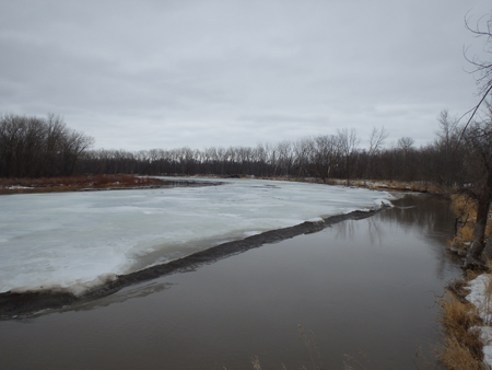
Ice jam monitoring, April 19, 2014 on the lower Assiniboine River
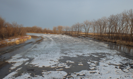
Ice jam monitoring at PR 430 Bridge, April 23, 2014
Flooding on Lake Manitoba
Since 2011 the Fairford River Water Control Structure (FRWCS) has generally been operated for maximum possible outflow. A temporary reduction in outflow in the winter is sometimes necessary to minimize the risk of flooding downstream on the Dauphin River due to frazil ice jams. Winter operation requires the installation of stop logs to reduce flow through the structure. In early spring of 2014 the FRWCS was already operating at full capacity to reduce levels on Lake Manitoba.
By early April the water level on Lake Manitoba was 247.44 metres (811.81 feet), within the normal operating range of 247 to 247.6 metres (810.5 to 812.5 feet). However, the water level was above the temporary operating range recommended by the Lake Manitoba and Lake St. Martin Regulation Review Committee, which was 246.9 to 247.5 metres (810 to 812 feet) for a period of five years.
Higher than average rainfall in April, May and June led to increased flows from a number of sources, including the Waterhen River, the Assiniboine River via the Portage Diversion and some local inflows. Prior to the June 27 to June 30 rainfall, the water level on Lake Manitoba was at 247.95 m (813.5 feet) and was forecasted to peak at 248 m to 248.05 m (813.6 feet to 813.8 feet) in early July.
By early July the lake level had risen close to the flood stage of 248.11 metres (814 feet). The wind eliminated water level on Lake Manitoba crested at 248.28 metres (814.6 feet) on July 28 and remained near that level until mid-September when water levels began to slowly decline.
|
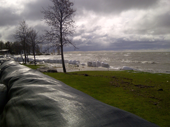
Super sandbags and Geotubes installed at Laurentia Beach October, 2014 |
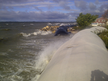
Geotubes located at Twin Beaches, Lake Manitoba, October, 2014 |
Flooding on Lake St. Martin
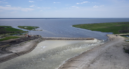
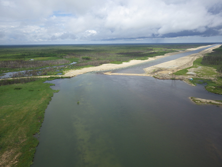
In early spring the Fairford River Water Control Structure was already operating at full capacity to help reduce water levels on Lake Manitoba. In the February and March, Lake St. Martin levels were already high for that time of year. With wet conditions persisting across much of southern Manitoba for the month of June and with high water levels already evident for many of Manitoba’s larger lakes, equipment was staged at Reach 1 of the Lake St. Martin emergency outlet channel in March. On June 25, 2014 Manitoba announced that the Lake St. Martin Emergency Outlet Channel (LSMEOC) would be reopened due to high lake levels caused by high rainfall through the late spring and early summer. The decision to reopen the LSMEOC was made prior to the rainfall event from June 27 to 30 that caused significant overland flooding and pushed the Assiniboine River and many other streams into flood stage.
Work began on July 2, 2014 to open the LSMEOC and it began operating on July 6 to increase outflow from Lake St. Martin and help lower lake levels from a peak of 803.6 feet to 803.0 feet by July 18.
Due to concerns of local stakeholders, LSMEOC was not opened to full capacity; only approximately one third of the 120 metre (36.57 feet) channel opening was removed. Flows through the Lake St. Martin Emergency Outlet Channel peaked at approximately 130.25 cms (4,600 cfs).
The partial opening was done to balance flood reduction benefits the channel provides to Lake St. Martin and the potential downstream impacts resulting from its operation. Even partially opened, the channel provided a significant flood reduction benefit, helping lower water levels on Lake St. Martin in spite of the high inflows from Lake Manitoba.
In November 2014, further work was done to open the channel to approximately half of its full width. The channel was not opened fully due to the commencement of frazil ice formation downstream on the Dauphin River. The LSMEOC remained partially open over the 2014/15 winter season.
Flooding on Lake Winnipegosis and the Waterhen River
Water flows into Lake Winnipegosis from the north slopes of the Riding Mountains to just south of Cedar Lake, and also from parts of eastern Saskatchewan. The main outlet from Lake Winnipegosis is the Waterhen River, which connects Lake Winnipegosis to the north basin of Lake Manitoba. At the start of the spring runoff in mid April the level of the lake rose due to persistent precipitation throughout the spring and increased tributary flows. The recorded peak daily water level occurred on July 1, 2014 at approximately 254.72 metres (835.70 feet), Adjusting for wind effects the wind eliminated peak level occurred around mid-July at approximately 254.29 metres (834.3 feet). By mid-October the wind eliminated lake level was estimated to be approximately 254.05 metres (833.5 feet).


