
Resources and Publications
Publication Sales
Releases for 2024
|
April 11, 2024 April 2, 2024 |
|

Publications may be available in alternate formats upon request.
Releases for April 11, 2024
DATA REPOSITORY ITEMS
DRI2024001
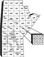
Till heavy mineral analysis (gold, MMSIM, visual KIM) from eight sections near the confluence of the Hayes and Gods rivers, northeastern Manitoba (parts of NTS 54C2, 7)
by M.S. Gauthier, L.N. Mesich and T.J. Hodder
(Microsoft® Excel® file)
Free download: manitoba.ca/iem/info/libmin/DRI2024001.xlsx
DRI2024002
Till geochemistry from eight sections near the confluence of the Hayes and Gods rivers, northeastern Manitoba (parts of NTS 54C2, 7)
by L.N. Mesich, M.S. Gauthier and T.J. Hodder
(Microsoft® Excel® file)
Free download: manitoba.ca/iem/info/libmin/DRI2024002.xlsx
Release for April 2, 2024
 OPEN FILE
OF2024-1
Quaternary site, till composition and ice-flow indicator datasets in the Kaskattama highland area, northeastern Manitoba (parts of NTS 53N, O, 54B, C)
by T.J. Hodder, M.S. Gauthier, S.E. Kelley and M. Ross
The Kaskattama highland area in northeastern Manitoba preserves an exceptional stratigraphic record of multiple Quaternary glacial-interglacial cycles. Helicopter-supported fieldwork investigated the Quaternary stratigraphy at 27 sections and the surficial sediments at 54 stations. This publication provides the stratigraphic columns, clast fabric, till clast-lithology and till-matrix geochemical data.
Free download: manitoba.ca/iem/info/libmin/OF2024-1.zip