Land Use and Development
Manitoba is a vast province rich with natural heritage. As a result, there is pressure to utilize this heritage from a diversity of interests (e.g. forestry, mining, tourism, agriculture, recreation, settlement and other land uses). To sustain a healthy ecosystem, it is important that the demand for development is balanced with the need to protect and preserve valuable resources and the environment.
Land use planning helps communities establish their vision for the future use of land, resources and natural features, and outlines the steps required to achieve that vision. It involves managing land uses and deciding where best to develop homes, parks, agriculture and industry, and where things should be left in their natural state. Land use planning is an essential part of building healthy, prosperous and sustainable communities.
Through the planning process, communities can decide the future course of their growth and development and ensure that citizens are involved in the decision making. Sound planning will balance private and public interests and help communities manage change, avoid land use conflicts and respond to future challenges. Land use planning in Manitoba is a partnership between the provincial and local governments and their citizens. Each plays a key role in ensuring the planning process is a success.
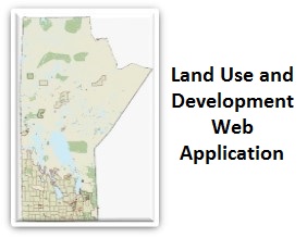
To help understand the planning policies and regulations in Manitoba, Community Planning developed an interactive map called the Land Use and Development Web Application. It is a geographic information system that shows development plans and zoning information for all lands in Manitoba outside the City of Winnipeg (follow this link for City of Winnipeg information). In addition to the land use designations and zones contained in the development plans and zoning bylaws adopted by municipalities or planning districts, the application also features information representing Assessment Parcel Information from Manitoba Assessment Online, and various basemaps that help the user understand the landscape of their area of interest. It also has tools that enable users to perform land use analyses to help them understand and visualize their communities development potential.
Please note that this data is for reference and discussion purposes only. Please check with the organization responsible for the orginal source information for verification.
To access the web application, click the link below.
Please ensure your browser settings allow pop-ups to view the map from this site. To view the map guide, please click here.
- About Planning: Policies and Legislation
- Bill 37 Review
- Bill 37 Action Plan
- Planning Districts
- Planning Support Materials
- Subdivision Review and Approval
- Airport Vicinity Protection Area Regulations and Web Application
- Municipal Boundary Changes