
Historic Flood - 1997
The flood of 1997 was the most severe in Manitoba's Red River valley since 1852. Flooding in the Red River basin also saw high running water on other Manitoba rivers and the Red River flood directly or indirectly affected communities in:
|
|
|
A dry summer in 1996 was followed by heavy rain in the fall that greatly increased soil moisture, creating the possibility of flooding. The winter of 1996 was unusually long and cold. There were four blizzards with high winds and heavy snow that caused extensive drifting and made it hard to measure snow levels accurately. Total basin precipitation, from the start of winter to near the crest of the Red River in early May, totalled 221 millimetres (8.9 inches), well above the norm of 130 millimetres (5 inches). This figure may be underestimated because of the difficulty in accurately measuring drifting snow levels.
Gradual spring melting started in late March. A Colorado low at the beginning of April brought major snowfall of up to 90 millimetres (3.5 inches) to the Red River Valley. Melting resumed in mid-April and happened quickly.
Spring runoff volume for the Red River at Emerson (up to June 15) was 8.33 million cubic decametres (6.75 million acre-feet), representing an average runoff depth of 135 millimetres (5.3 inches). This is almost identical to the 1950 runoff volume. The runoff in spring 1997 was especially heavy in several areas:
- where the Red River starts near Halstad, North Dakota
- in the lower Pembina River Watershed
- on the eastern-most tributaries of the Red River in Manitoba
Many streams in these areas had record or near-record high water flow.
The Red River crested at approximately 7.5 metres (24.5 feet) at the James Avenue Pumping Station in Winnipeg. Without the flood control works, the crest would have been at 10.5 metres (35 feet).
Over 7,000 military personnel were employed for 36 days to help prevent flood damage and relocate 25,450 evacuees. An estimated 1,000 homes were damaged.
 |
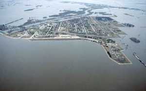 |
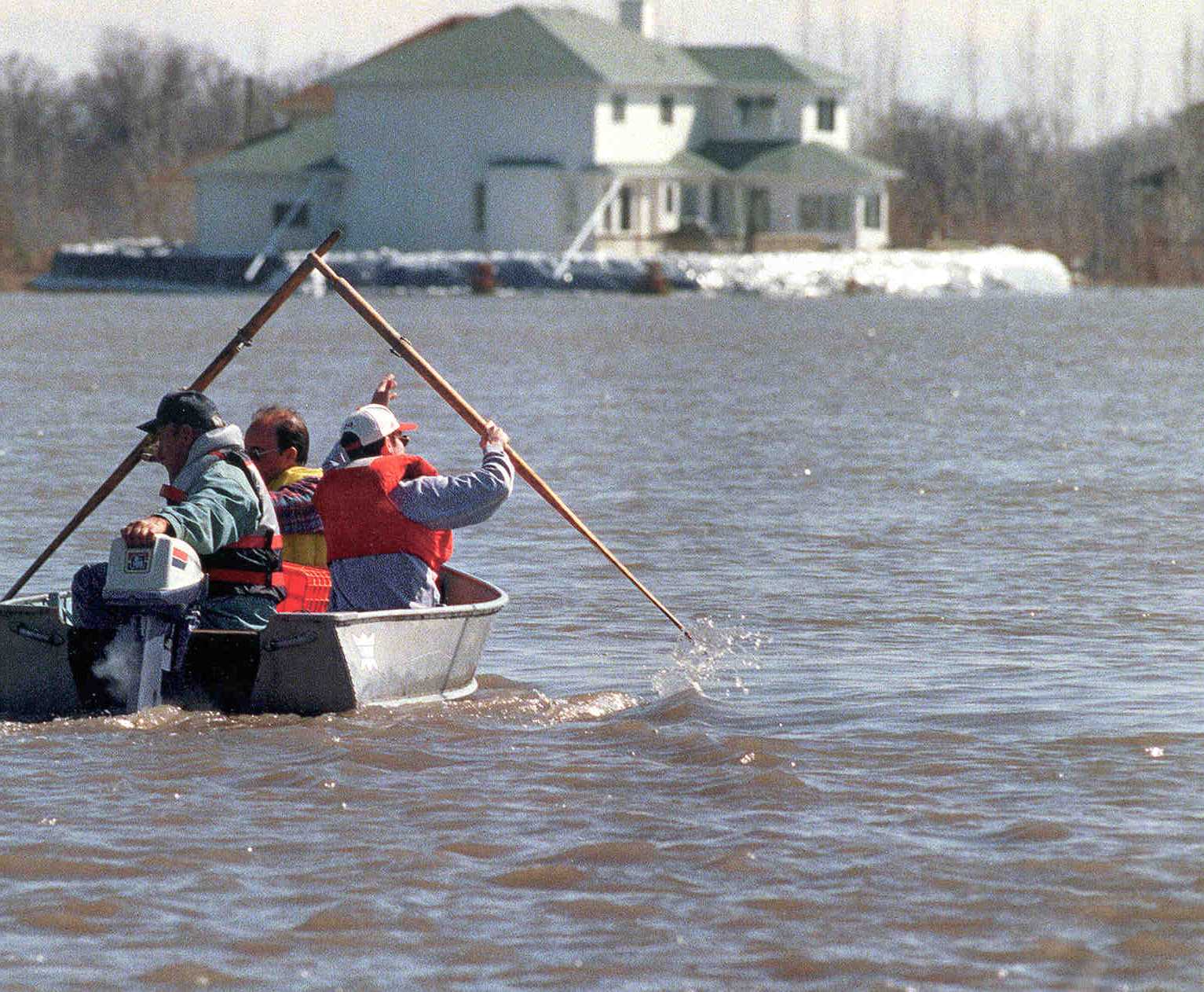
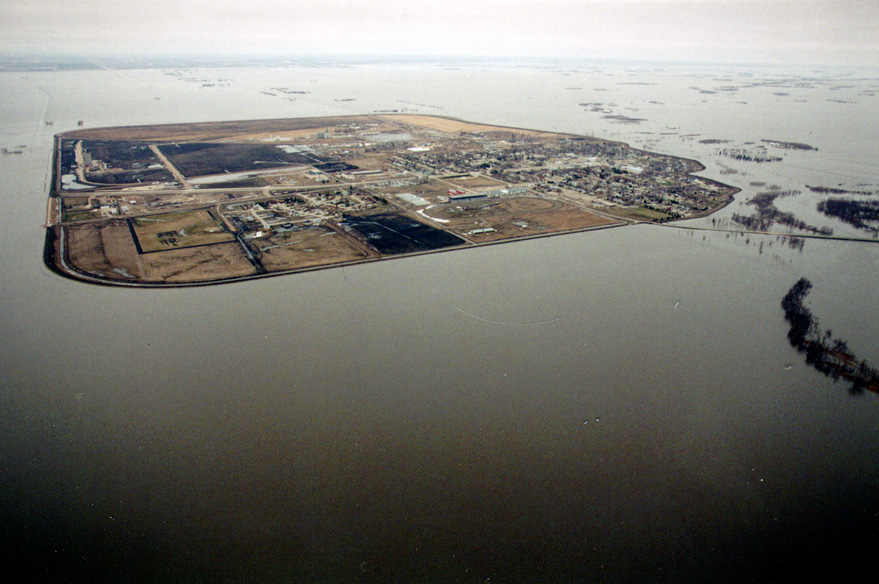
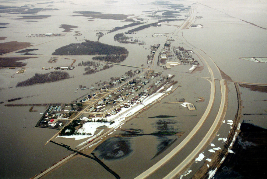
| Three men boating in a flooded residential area, 1997 | Aerial image of flooding outside of the Emerson ring dike, 1997 |
 |
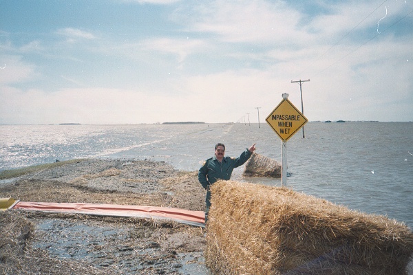 |
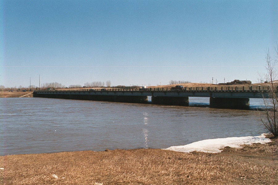
| Peak water levels just below PTH 59 in the floodway channel, 1997. | Man standing before a flooded road pointing to a sign that states "IMPASSABLE WHEN WET", 1997 |
 |
 |
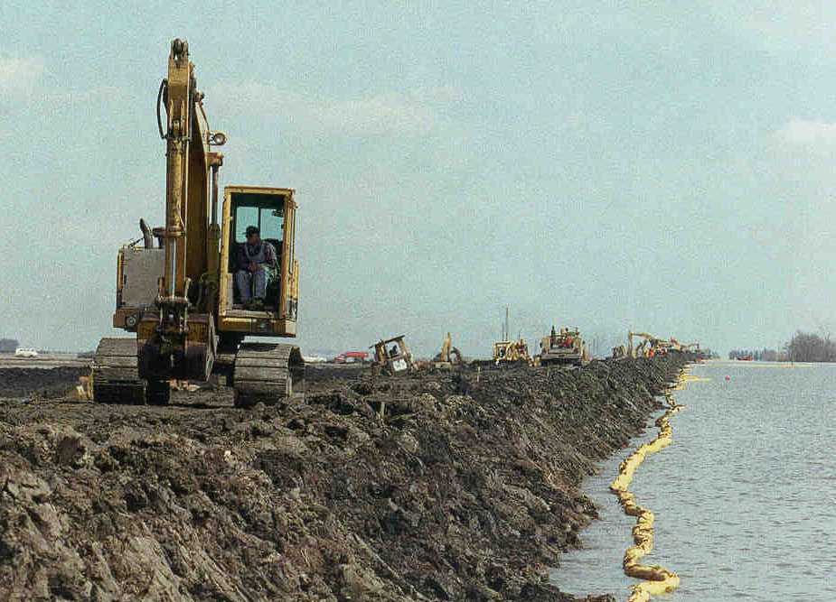
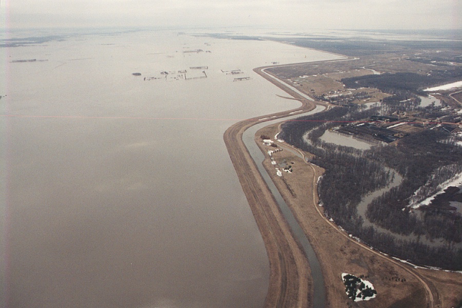
| Machines working on the West Dike during the flood of 1997 | Aerial image of flooding around the Morris ring dike, 1997 |
 |
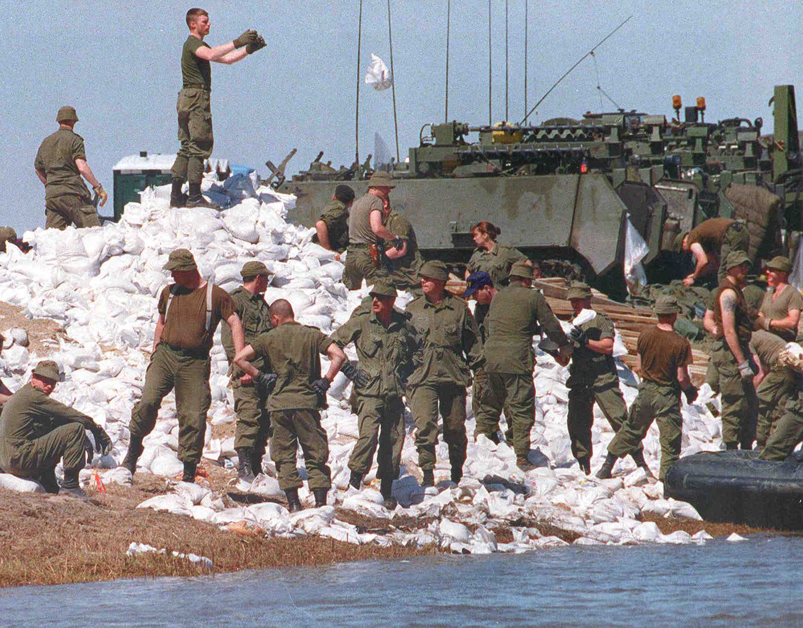 |
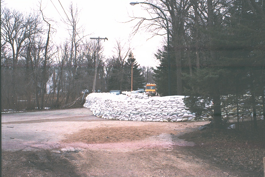
| Construction of a sandbag dike in St. Norbert, 1997 | Soldiers tossing sandbags during the flood of 1997 |
 |
 |
| Aerial image of flooding at Ste. Agathe, 1997 | Aerial image looking southwest showing flooding along West Dike, 1997 |
Links
- Flood of the Century (City of Winnipeg)
- The 1997 Red River flood in Manitoba, Canada (WF Rannie, University of Winnipeg)
- Red River Flood (The Canadian Encyclopedia)
Reports
Please visit the reports page for all Red River Flood Reports