Geoscience

 The Manitoba Geological Survey (MGS) is constructing a 3-D geological model of the province. The MGS is taking advantage of the latest developments in computer technology to create a model that has applications for groundwater modelling, oil and gas assessments and industrial mineral management.
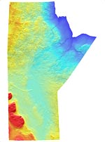
The data contained on this web site has been recently upgraded. All images on this website have been derived from version 2.0 of the Manitoba Digital Elevation Model, the original version 1.0 data is available for $10.00 on a CD-ROM which can be ordered from the Resource Centre.
PLEASE NOTE: The DEMSM content has been superseded by the SRTM data from NASA.
 |
 |


