
Resources and Publications
Publication Sales
Releases for 2021
|
December 21, 2021 December 2, 2021 November 17, 2021 September 21, 2021 August 25, 2021 August 17, 2021 August 13, 2021 June 23, 2021 June 18, 2021 June 11, 2021 June 10, 2021 June 9, 2021 June 8, 2021 June 2, 2021 April 26, 2021 April 15, 2021 March 18, 2021 March 2, 2021 January 4, 2021 |
|

Publications may be available in alternate formats upon request.
Release for December 21, 2021
GEOSCIENTIFIC REPORT SERIES
 GR2021-2
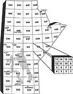
Geology of the Wuskwatim–Granville lakes corridor, Kisseynew domain, Manitoba (parts of NTS 63O, P, 64A–C)
by L.A. Murphy and H.V. Zwanzig
(94 p. plus accompanying Data Repository Item DRI2021014)
This report covers parts of two geological domains in the Paleoproterozoic Trans-Hudson orogen: the northeastern part of the Kisseynew domain (KD) and the south margin of the Leaf Rapids domain. The parts of the KD described in this report include the Kisseynew north flank and the Northeast Kisseynew subdomain. The bedrock of the north flank of the KD comprises abundant Paleoproterozoic, ca. 1.85–1.83 Ga metasedimentary rocks (the Burntwood group metaturbidite and the Sickle group subaerial to shallow-water metasandstone). Mineral showings along the Wuskwatim–Granville lakes transect have been considered, to date, as uneconomic but may be undervalued. A gold showing in sulphide-facies iron formation at the contact between Granville complex-type basalt/gabbro and the possible base of the Burntwood group, lies along a series of sulphide showings in shears that may represent a gold metallotect. Altered Granville complex basalt and ultramafic rocks feature elevated As, an element associated with Au. A glacial train of As anomalies and trace Au extends across the KD. A trace Cu showing on Notigi Lake may be related to stratiform copper mineralization that has been documented, also in the Sickle group, at Kadeniuk Lake, southwest of Granville Lake.
Free download: www.manitoba.ca/iem/info/libmin/GR2021-2.zip
Release for December 2, 2021
DATA REPOSITORY ITEM
DRI2021021
Bedrock geochemical data of the Ralph Lake area, Lynn Lake greenstone belt, northwestern Manitoba (parts of NTS 64C14)
by X.M. Yang
(Microsoft® Excel® file)
This Data Repository Item supplements:
Yang, X.M. 2021: Bedrock mapping at Ralph Lake, Lynn Lake greenstone belt, northwestern Manitoba (part of NTS 64C14): preliminary results and geological implications; in Report of Activities 2021, Manitoba Natural Resources and Northern Development, Manitoba Geological Survey, p. 40–58.
Free download: www.manitoba.ca/iem/info/libmin/DRI2021021.xlsx
Releases for November 17, 2021
REPORT OF ACTIVITIES 2021
A comprehensive summary of geological investigations conducted by the Manitoba Geological Survey (MGS) in the past year. The report includes new field programs, new digital initiatives, and collaborative ventures with the federal government, universities and the mineral exploration industry. The Report of Activities provides industry with the most current geoscience information available to help focus exploration strategies and assist with mineral investment decisions for the coming year.
(96 p.; PDF)
PDFs of the entire Report of Activities 2021 are available for download free of charge at www.manitoba.ca/iem/geo/field/index.html
PRELIMINARY MAPS
Note: Preliminary Maps are available in print for $10.00 plus PST or in PDF as a free download
PMAP2021-1
Bedrock geology of the Stuart Bay–Chickadee Lake area (east of Wekusko Lake), north-central Manitoba (parts of NTS 63J12, 13)
by K.D. Reid
(scale 1:15 000)
To Order
Free download: www.manitoba.ca/iem/info/libmin/PMAP2021-1.pdf
PMAP2021-2
Bedrock geology of the Ralph Lake area, Lynn Lake greenstone belt, northwestern Manitoba (parts of NTS 64C14)
by X.M. Yang
(scale 1:10 000)
To Order
Free download: www.manitoba.ca/iem/info/libmin/PMAP2021-2.pdf
DATA REPOSITORY ITEMS
DRI2021017
Lithogeochemistry of metasedimentary rocks of uncertain affinity from the Joey Lake area, and Ospwagan group and related rocks, Thompson nickel belt, central Manitoba (NTS 63O8, 9, 63P12)
by C.G. Couëslan
(Microsoft® Excel® file)
This Data Repository Item supplements:
Couëslan, C.G. 2021: Collection of samples for high-resolution detrital-zircon geochronology and lithogeochemistry in the Thompson nickel belt, central Manitoba (parts of NTS 63O8, 9, 63P12); in Report of Activities 2021, Manitoba Natural Resources and Northern Development, Manitoba Geological Survey, p. 18–28.
Free download: www.manitoba.ca/iem/info/libmin/DRI2021017.xlsx
DRI2021018
Kimberlite-indicator-mineral data derived from glacial sediments (till) in the Machichi–Kettle rivers area, far northeastern Manitoba (parts of NTS 54A–C)
by T.J. Hodder and M.S. Gauthier
(Microsoft® Excel® file)
This Data Repository Item supplements:
Hodder, T.J. and Gauthier, M.S. 2021: Kimberlite-indicator-mineral results from till sampled in the Machichi–Kettle rivers area, far northeastern Manitoba (parts of NTS 54A–C); in Report of Activities 2021, Manitoba Natural Resources and Northern Development, Manitoba Geological Survey, p. 77–83.
Free download: www.manitoba.ca/iem/info/libmin/DRI2021018.xlsx
DRI2021019
Updates to the Manitoba Mineral Deposits Database, east-central Manitoba (NTS 53E, F)
by M.L. Rinne
(Microsoft® Excel® file)
This Data Repository Item supplements:
Rinne, M.L. 2021: Updates to the Manitoba Mineral Deposits Database, east-central and northwestern Manitoba (NTS 53E, F, 64J, K, N, O); in Report of Activities 2021, Manitoba Natural Resources and Northern Development, Manitoba Geological Survey, p. 1–7.
Note: This DRI has been superseded by GeoFile 5.
DRI2021020
Kimberlite-indicator-mineral data derived from glacial sediments (till) in the Russell–McCallum lakes area of northwestern Manitoba (parts of NTS 64C3–6)
by T.J. Hodder
(Microsoft® Excel® file)
This Data Repository Item supplements:
Hodder, T.J. 2019: Till sampling and ice-flow mapping in the Russell–McCallum lakes area, northwestern Manitoba (parts of NTS 64C3–6); in Report of Activities 2019, Manitoba Natural Resources and Northern Development, Manitoba Geological Survey, p. 90–96.
Free download: www.manitoba.ca/iem/info/libmin/DRI2021020.xlsx
Releases for September 21, 2021
DATA REPOSITORY ITEMS
DRI2021015
Lithogeochemistry of drillcore from the Phillips Lake area, and samples from the Paint Lake area, Thompson nickel belt, central Manitoba (NTS 63O1, 8, 63P5)
by C.G. Couëslan
(Microsoft® Excel® file)
Free download: www.manitoba.ca/iem/info/libmin/DRI2021015.xlsx
DRI2021016
Lithogeochemistry of iron formation, calcsilicate, marble, and mafic dikes from the Thompson nickel belt, central Manitoba (NTS 63O8, 9, 63P5, 12, 15)
by C.G. Couëslan
(Microsoft® Excel® file)
Free download: www.manitoba.ca/iem/info/libmin/DRI2021016.xlsx
DRI2020028
Lithogeochemistry of drillcore from the Huzyk Creek property, central Manitoba (NTS 63J6)
by C.G. Couëslan
(Microsoft® Excel® file)
Free download: www.manitoba.ca/iem/info/libmin/DRI2020028.xlsx
Notes:
- This Data Repository Item was originally released on November 18, 2020.
- It was re-released on September 21, 2021 with the addition of Tables 6_1, 6_2 and 6_3.
Release for August 25, 2021
DATA REPOSITORY ITEM
DRI2021012
Whole-rock geochemistry results of bedrock samples from the Misty Lake area, Manitoba (parts of NTS 64K12, 13, 64N4)
by P.D. Kremer, A.R. Carlson, C.G. Couëslan and T. Martins
(Microsoft® Excel® file)
Free download: www.manitoba.ca/iem/info/libmin/DRI2021012.xlsx
Notes:
- This Data Repository Item was originally released on July 12, 2021.
- It was re-released on July 23, 2021 with the following updates:
The geographic coordinates have been updated for samples 107-10-168 (Table 1_2, row 40, columns C to F), 107-10-176A (Table 2_2, row 26, columns C to F) and 107-10-47B (Table 3_2, row 9, columns C to F). - It was re-released on August 25, 2021 with additional data added to column G ("Rock_Type") in tables 1_2, 2_2 and 3_2.
Supplements:
Kremer, P.D., Carlson, A.R. and Couëslan, C. 2010: Far North Geomapping Initiative: geological mapping in the Misty Lake area, Manitoba (parts of NTS 64K12, 13, 64N4); in Report of Activities 2010, Manitoba Innovation, Energy and Mines, Manitoba Geological Survey, p. 50–61.
Release for August 17, 2021
DATA REPOSITORY ITEM
DRI2018001
Kimberlite-indicator–mineral data derived from glacial sediments (till) in the Kaskattama highland area of northeastern Manitoba (parts of NTS 53N, O, 54B, C)
by T.J. Hodder
(Microsoft® Excel® file)
Free download: www.manitoba.ca/iem/info/libmin/DRI2018001.xlsx
Notes:
- This Data Repository Item was originally released on November 22, 2018.
- In Table 1, column H ("Sample weight (kg)") has been added.
- In Table 3, columns F ("Sample weight (kg)") and Q ("Total KIM per 10 kg sample") have been added..
Supplements:
Hodder, T.J. and Kelley, S.E. 2018: Kimberlite-indicator minerals and clast-lithology composition of till, Kaskattama highland region, northeastern Manitoba (parts of NTS 53N, O, 54B, C); in Report of Activities 2018, Manitoba Growth, Enterprise and Trade, Manitoba Geological Survey, p. 150–165.
Release for August 13, 2021
DATA REPOSITORY ITEM
DRI2021013
Laser-ablation, multicollector, inductively coupled plasma–mass spectrometry U-Pb isotopic analyses of detrital zircon grains from the Ospwagan group, Setting formation metagreywacke sample 12-04-4462, Setting Lake, central Manitoba (part of NTS 63O2)
by H.V. Zwanzig, C.O. Böhm and C.G. Couëslan
(Microsoft® Excel® file)
Free download: www.manitoba.ca/iem/info/libmin/DRI2021013.xlsx
Releases for June 23, 2021
GEOSCIENTIFIC REPORT SERIES
 GR2021-1
Bedrock geology of the central Sipiwesk Lake area, Pikwitonei granulite domain, central Manitoba (part of NTS 63P4)
by C.G. Couëslan
(47 p. plus 1 appendix and 1 map at 1:20 000 scale)
A mapping campaign in the Pikwitonei granulite domain (PGD) of Manitoba was initiated in the summer of 2012 with work in the central Sipiwesk Lake area. Previous mapping in the area utilized descriptive petrography, and the majority of units were classified as either granofels (sic) or enderbites, which were further separated by the use of mineral-assemblage qualifiers (e.g., garnet-plagioclase-quartz-pyroxene±hornblende granofels and gneiss). One of the primary goals of the new mapping initiative was to remap the area and add protolith interpretation to define rock units. This was accomplished by integrating field observations with lithogeochemistry, isotope analyses and phase-equilibria modelling. However, interpretation of a protolith was not always possible because of the high metamorphic grade. It is hoped that an understanding of the origins of the gneisses that make up the PGD will lead to a better understanding of the domain and its relationship to adjacent domains and greenstone belts of the Superior province.
Free download: www.manitoba.ca/iem/info/libmin/GR2021-1.zip
DATA REPOSITORY ITEM
DRI2021009
Whole-rock geochemistry results for Sharpe Lake, Superior province, east-central Manitoba (parts of NTS 53K5, 6)
by Manitoba Geological Survey
(Microsoft® Excel® file)
Free download: www.manitoba.ca/iem/info/libmin/DRI2021009.xlsx
Supplements:
Beaumont-Smith, C.J., Anderson, S.D., Bailes, A.H. and Corkery, M.T. 2003: Preliminary results and economic significance of geological mapping and structural analysis at Sharpe Lake, northern Superior Province, Manitoba (parts of NTS 53K5 and 6); in Report of Activities 2003, Manitoba Industry, Economic Development and Mines, Manitoba Geological Survey, p. 140–158.
Corkery, M.T., Beaumont-Smith, C.J., Anderson, S.D. and Bailes, A.H. 2003: Geology of the eastern Sharpe Lake area, Manitoba (NTS 53K6); Manitoba Industry, Economic Development and Mines, Manitoba Geological Survey, Preliminary Map PMAP2003-5, scale 1:50 000.
Corkery, M.T., Beaumont-Smith, C.J., Anderson, S.D. and Bailes, A.H. 2003: Geology of the western Sharpe Lake area, Manitoba (NTS 53K5); Manitoba Industry, Economic Development and Mines, Manitoba Geological Survey, Preliminary Map PMAP2003-4, scale 1:50 000.
Releases for June 18, 2021
DATA REPOSITORY ITEMS
DRI2012001
Whole-rock geochemistry of the Burntwood Lake alkali-feldspar syenite, west-central Manitoba (part of NTS 63N8)
by T. Martins
(Microsoft® Excel® file)
Free download: www.manitoba.ca/iem/info/libmin/DRI2012001.xls
Notes:
- This Data Repository Item was originally released on June 21, 2012.
- In column C/D, row 2 of the table, the term "NAD 86 Zone 14" was corrected to read "NAD83 Zone 14".
Supplements:
Martins, T., Couëslan, C.G. and Böhm, C.O. 2011: The Burntwood Lake alkali-feldspar syenite revisited, west-central Manitoba (part of NTS 63N8); in Report of Activities 2011, Manitoba Innovation, Energy and Mines, Manitoba Geological Survey, p. 79–85.
DRI2017004
Whole-rock and mineral geochemistry as exploration tools for rare-element pegmatite in Manitoba: examples from the Cat Lake–Winnipeg River and Wekusko Lake pegmatite fields (parts of NTS 52L6, 63J13)
by T. Martins and R.L. Linnen
(Microsoft® Excel® file)
Free download: www.manitoba.ca/iem/info/libmin/DRI2017004.xlsx
Notes:
- This Data Repository Item was originally released on November 15, 2007.
- The data found in Table 1, column B, rows 35 to 62 were updated to include a "0" at the end of each number.
Supplements:
Martins, T., Linnen, R.L.,
Fedikow, M.A.F. and Singh, J.
2017: Whole-rock and mineral
geochemistry as exploration
tools for rare-element pegmatite
in Manitoba: examples from
the Cat Lake–Winnipeg River
and Wekusko Lake pegmatite
fields (parts of NTS 52L6, 63J13); in Report of Activities 2017,
Manitoba Growth, Enterprise
and Trade, Manitoba Geological
Survey, p. 42–51.
Release for June 11, 2021
DATA REPOSITORY ITEM
DRI2021011
Whole-rock geochemistry of bedrock samples from the Snyder Lake area, northwestern Manitoba (part of NTS 64N5)
by P.D. Kremer, C.O. Böhm and T. Martins
(Microsoft® Excel® file)
Supplements:
Kremer, P.D., Böhm, C.O. and Rayner, N. 2011: Far North Geomapping Initiative: bedrock geology of the Snyder Lake area, northwestern Manitoba (part of NTS 64N5); in Report of Activities 2011, Manitoba Innovation, Energy and Mines, Manitoba Geological Survey, p. 6–17.
Free download: www.manitoba.ca/iem/info/libmin/DRI2021011.xlsx
Release for June 10, 2021
DATA REPOSITORY ITEM
DRI2021010
Till geochemistry and heavy mineral analyses of the western Fox River greenstone belt area, northeastern Manitoba (NTS 53M15, 16), plus 4 samples from the Gillam area (parts of 54D7, 11)
by M.S. Gauthier and T.J. Hodder
(Microsoft® Excel® file)
Free download: www.manitoba.ca/iem/info/libmin/DRI2021010.xlsx
Releases for June 9, 2021
GEOSCIENTIFIC MAPS
 MAP2021-1
Bedrock topography of southern Manitoba
by G.R. Keller and G.L.D. Matile
(scale 1:1 000 000)
This map provides an overview of the bedrock topography at a regional scale. It was constructed using a combination of drillhole and geological mapping data originally plotted and interpreted by hand, modelled in GOCAD® software and subsequently interpolated in ArcGIS. This dataset represents the Manitoba Geological Survey's interpretation of the available data and was originally modelled from east-west–oriented cross-sections at a 5 km north-south spacing from the United States border to 54°N; no additional data has been added for this release. Additional background can be found in the map's surround.
Free download: www.manitoba.ca/iem/info/libmin/MAP2021-1.pdf
 MAP2021-2
Drift thickness of southern Manitoba
by G.R. Keller and G.L.D. Matile
(scale 1:1 000 000)
This map provides an overview of the drift thickness at a regional scale. The drift thickness of southern Manitoba was calculated using the difference between interpreted bedrock topography and the Shuttle Radar Topography Mission 90 metre Digital Elevation Model. The bedrock topography of southern Manitoba was reconstructed using a combination of drillhole and geological mapping data originally plotted and interpreted by hand, modelled in GOCAD® software and subsequently interpolated in ArcGIS. This dataset represents the Manitoba Geological Survey's interpretation of the available data and was originally modelled from east-west–oriented cross-sections at a 5 km north-south spacing from the United States border to 54°N; no additional data has been added for this release. Additional background can be found in the map's surround.
Free download: www.manitoba.ca/iem/info/libmin/MAP2021-2.pdf
Release for June 8, 2021
DATA REPOSITORY ITEM
DRI2021008
Compilation of Sm-Nd isotope results and accompanying whole-rock geochemistry (to 2017) for the Trans-Hudson orogen, Manitoba (parts of NTS 63F, J, K, 63N–P, 64A–C, 64F–H)
by Manitoba Geological Survey
(Microsoft® Excel® file)
Free download: www.manitoba.ca/iem/info/libmin/DRI2021008.xlsx
Release for June 2, 2021
DATA REPOSITORY ITEM
DRI2019007
Whole rock geochemistry compilation of the Oxford Lake–Knee Lake greenstone belt, northwestern Superior Province, Manitoba (parts of NTS 53L6, 12–15, 53M2, 63I9, 16)
by S. Anderson and T. Martins
(Microsoft® Excel® file)
Free download: www.manitoba.ca/iem/info/libmin/DRI2019007.xlsx
Notes:
- This Data Repository Item was originally released on December 23, 2019.
- An initial update on June 1, 2021 moved the data which originally appeared in Table 3, column J, rows 77 to 79 to appear in column J, rows 78 to 80 in the same table.
- A second update on June 2, 2021 added data to Table 3, column J, row 77.
Supplements:
Anderson, S.D., Kremer, P.D. and Martins, T. 2012: Preliminary results of bedrock mapping at Oxford Lake, northwestern Superior Province, Manitoba (parts of NTS 53L12, 13, 63I9, 16); in Report of Activities 2012, Manitoba Innovation, Energy and Mines, Manitoba Geological Survey, p. 6–22.
Anderson, S.D., Kremer, P.D. and Martins, T. 2013: Preliminary results of bedrock mapping at Oxford Lake, northwestern Superior province, Manitoba (parts of NTS 53L13, 14); in Report of Activities 2013, Manitoba Mineral Resources, Manitoba Geological Survey, p. 7–22.
Anderson, S.D., Syme, E.C., Corkery, M.T., Bailes, A.H. and Lin, S. 2015: Preliminary results of bedrock mapping at southern Knee Lake, northwestern Superior province, Manitoba (parts of NTS 53L14, 15); in Report of Activities 2015, Manitoba Mineral Resources, Manitoba Geological Survey, p. 9–23.
Anderson, S.D. 2016: Preliminary results of bedrock mapping at central Knee Lake, northwestern Superior province, Manitoba (parts of NTS 53L15, 53M2); in Report of Activities 2016, Manitoba Growth, Enterprise and Trade, Manitoba Geological Survey, p. 1–15.
Anderson, S.D. 2016: Alkaline rocks at Oxford Lake and Knee Lake, northwestern Superior province, Manitoba (NTS 53L13, 14, 15): preliminary results of new bedrock mapping and lithogeochemistry; in Report of Activities 2016, Manitoba Growth, Enterprise and Trade, Manitoba Geological Survey, p. 16–27.
Anderson, S.D. 2017: Preliminary geology of the diamond occurrence at southern Knee Lake, Oxford Lake–Knee Lake greenstone belt, Manitoba (NTS 53L15); Manitoba Growth, Enterprise and Trade, Manitoba Geological Survey, Open File OF2017-3, 27 p.
Release for April 26, 2021
 OPEN FILE
OF2021-1
Manitoba radiocarbon ages: update
by M.S. Gauthier
This Open File provides the first update on Manitoba radiocarbon ages since 2000. The digital dataset is a compilation of 1371 geologic and archaeologic radiocarbon ages, provided as both conventional radiocarbon ages (14C year BP) and calibrated ages (cal year BP). It includes a determination of anomalous and maybe-anomalous ages that should be discarded or confirmed by the user in future work. This data can be brought into GIS software, and integrated with other data, to further chronological reconstructions in Manitoba.
Note: This publication supersedes Geological Report GR80-4 and Open File Report OF2000-1.
Note: This Open File has been superseded by GeoFile 6.
Release for April 15, 2021
DATA REPOSITORY ITEM
DRI2021007
Till-matrix geochemistry data, Machichi–Kettle rivers area, far northeastern Manitoba (parts of NTS 54A–C)
by T.J. Hodder and M.S. Gauthier
(Microsoft® Excel® file)
Note: This publication has been superseded by Data Repository Item DRI2022006.
Releases for March 18, 2021
DATA REPOSITORY ITEMS
DRI2021004
Whole-rock geochemistry of bedrock samples along East Side Road, southeastern Manitoba (parts of NTS 62P1, 7, 8, 10, 15, 63A2, 7)
by M.L. Rinne
(Microsoft® Excel® file)
This Data Repository Item supplements:
Rinne, M.L. 2020: Results of reconnaissance bedrock mapping along East Side Road, southeastern Manitoba (parts of NTS 62P1, 7, 8, 10, 15, 63A2, 7); in Report of Activities 2020, Manitoba Natural Resources and Northern Development, Manitoba Geological Survey, p. 1–8.
Free download: www.manitoba.ca/iem/info/libmin/DRI2021004.xlsx
DRI2021005
Compilation of Sm-Nd isotope results from the Manitoba Geological Survey 2020/2021 season
by Manitoba Geological Survey
(Microsoft® Excel® file)
Free download: www.manitoba.ca/iem/info/libmin/DRI2021005.xlsx
DRI2021006
Till geochemistry from Manigotagan to Berens River, southeastern Manitoba (parts of NTS 62P1, 7, 8, 10, 15, 63A2, 7)
by M.S. Gauthier and T.J. Hodder
(Microsoft® Excel® file)
Free download: www.manitoba.ca/iem/info/libmin/DRI2021006.xlsx
Release for March 2, 2021
DATABASE
Lynn Lake Bedrock Compilation Map Database (2021)
Digital bedrock compilation map database of the Lynn Lake belt (NTS 64C10 to 16, 64B13), based on:
- Maps GP80-1-1 to GP80-1-5 (1:50 000 scale, revised in 1980) included in Geological Paper GP80-1: Geology of the metavolcanic and volcaniclastic metasedimentary rocks in the Lynn Lake area, by H.P. Gilbert, E.C. Syme, and H.V. Zwanzig
- Maps GR87-3-1 and GR87-3-3 (1:50 000 scale) included in Geological Report GR87-3: Geology of the Barrington Lake-Melvin Lake-Fraser Lake area, by H.P. Gilbert
Includes maps in PDF of the following areas:
- Barrington Lake, Manitoba (NTS 64C16)
- Cockeram Lake, Manitoba (NTS 64C15)
- Fraser Lake, Manitoba (NTS 64B13)
- Laurie Lake, Manitoba (NTS 64C12)
- Lynn Lake, Manitoba (NTS 64C14)
- McGavock Lake, Manitoba (NTS 64C11)
- McMillan Lake, Manitoba (NTS 64C13)
- Sickle Lake, Manitoba (NTS 64C10)
Free download: www.manitoba.ca/iem/info/libmin/lynn_lake_compilation_2021.zip
NOTE: This database supersedes the version released on July 5, 2019.
Releases for January 4, 2021
DATA REPOSITORY ITEMS
DRI2021001
Whole-rock geochemistry results of Bear Lake, Superior province, east-central Manitoba (parts of NTS 53M4, 63P1)
by C.O. Böhm, R.P. Hartlaub and T. Martins
(Microsoft® Excel® file)
This Data Repository Item supplements:
Böhm, C.O. and Hartlaub, R.P. 2006: Bedrock geology of the Bear Lake area, Manitoba (parts of NTS 53M4 and 63P1); Manitoba Science, Technology, Energy and Mines, Manitoba Geological Survey, Preliminary Map PMAP2006-2, scale 1:50 000.
Hartlaub, R.P. and Böhm, C.O. 2006: Preliminary results from geological mapping of the Bear Lake greenstone belt, Manitoba (parts of NTS 53M4 and 63P1); in Report of Activities 2006, Manitoba Science, Technology, Energy and Mines, Manitoba Geological Survey, p. 65–73.
Free download: www.manitoba.ca/iem/info/libmin/DRI2021001.xlsx
DRI2021002
Whole-rock geochemistry results for Utik Lake, Superior province, east-central Manitoba (parts of NTS 53M4, 5, 63P1, 8)
by C.O. Böhm, P.D. Kremer, E.C. Syme and T. Martins
(Microsoft® Excel® file)
This Data Repository Item supplements:
Böhm, C.O. and Kremer, P.D. 2007: Bedrock geology of the Utik Lake greenstone belt, Manitoba (parts of NTS 53M4, 5 and 63P1, 8); Manitoba Science, Technology, Energy and Mines, Manitoba Geological Survey, Preliminary Map PMAP2007-4, scale 1:25 000.
Böhm, C.O., Kremer, P.D. and Syme, E.C. 2007: Nature, evolution and gold potential of the Utik Lake greenstone belt, Manitoba (parts of NTS 53M4, 5, 63P1, 8): preliminary field results; in Report of Activities 2007, Manitoba Science, Technology, Energy and Mines, Manitoba Geological Survey, p. 98–113.
Free download: www.manitoba.ca/iem/info/libmin/DRI2021002.xlsx
DRI2021003
Compilation of Sm-Nd isotope results from Utik Lake, Superior province, east-central Manitoba (parts of NTS 53M4, 5, 63P1, 8)
by C.O. Böhm, P.D. Kremer, E.C. Syme and T. Martins
(Microsoft® Excel® file)
This Data Repository Item supplements:
Böhm, C.O. and Kremer, P.D. 2007: Bedrock geology of the Utik Lake greenstone belt, Manitoba (parts of NTS 53M4, 5 and 63P1, 8); Manitoba Science, Technology, Energy and Mines, Manitoba Geological Survey, Preliminary Map PMAP2007-4, scale 1:25 000.
Böhm, C.O., Kremer, P.D. and Syme, E.C. 2007: Nature, evolution and gold potential of the Utik Lake greenstone belt, Manitoba (parts of NTS 53M4, 5, 63P1, 8): preliminary field results; in Report of Activities 2007, Manitoba Science, Technology, Energy and Mines, Manitoba Geological Survey, p. 98–113.
Free download: www.manitoba.ca/iem/info/libmin/DRI2021003.xlsx